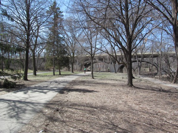
With both of our bikes loaded up in the back, we set out on Thursday morning down PTH 75 to the border. It is a path so familiar that I can almost picture it in my sleep, yet I always manage to spot something new along the route.
I noticed that the speedway near St. Adolphe is on its third name. The former Winnipeg Speedway and Victory Lanes is now Red River Speedway. Perhaps it has been this way for some time. I’d check into it if I cared more.
I was struck by the number of new homes going up north and south of Ste. Agathe. I never would have thought that a flood-prone community like this would be the hotbed of new home construction. I hope that these homes are built with two or more floors so that the lucky homeowners have a place to keep their valued possessions dry.
I also noticed that there was a new wind farm south of the junction of PTH 14. It looked similar in size to the wind farm off PTH 23 near St. Leon.
Regrettably, one of the things that hadn’t changed was the low-lying bridge over the Morris River that floods like clockwork each spring and forces the closure of the highway. Fortunately, it was still open for us, but it still amazes me that the government has not replaced it. They have replaced numerous bridges over the Floodway, yet what is unquestionably the Achilles heel of the Manitoba highway system has received no attention whatsoever.
In reality, however, I shouldn’t be surprised. The NDP government has shown that its priorities lie elsewhere. Like building that $200-million saloon in Fort Garry and lining Mark Chipman’s pocket, for instance.
Before crossing the border, we stopped at the Emerson Duty Free store to use Manitoba’s favorite bathroom. Just as we stepped inside, this sign jumped out at me:

I should
have asked one of the clerks where “Danada” was.
This is the exact sign that I got a picture of several years ago and it still hasn’t been corrected. Perhaps they’re leaving it as a conversation piece. More likely, however, they don’t care enough to change it.
I can only shake my head.
While waiting in the line at U.S. Customs, I noticed the following sign:

It’s “Douane”, not “Duane.” Looks like people on both sides of the border are guilty of bad spelling on signs.
After a short wait, we were on our way south on I-29. Interestingly, it was the first time that I had passed through one of the car lanes since the new building went up at the Pembina Port of Entry many years ago. Each of my recent crossings has been through the bus lane on the east side.
For those of you old enough to remember, there used to be a small, box-like building with pale green tiles on the sides that used to stand at that location. Facing the incoming traffic was a stone engraved with the name of President John F. Kennedy. Today, the stone facing the bus lane is engraved with the name of William Jefferson Clinton, the husband of the sitting President at that time.
At my request, we stopped at the Alexander Henry rest area near Exit 180.

The current structure bears little resemblance to the one that stood there when I was a child. It was built like an old-style fort with tall, spiked wooden planks, faded and weather-beaten, where kids like me could run around and play the role of someone like General Custer protecting the homesteaders.
It was when
that fort was still standing that I last visited that rest area. Back then, we
were still using rotary dial phones. Today, free Wi-Fi is available there. How
times have changed.
I noticed a
number of sugar beet trucks on both sides of the highway as we got closer to Sucker Town.
Those same trucks would be dotting the highway on our way back as well.
Between Sucker Town
and Fargo,
scenes like this were commonplace on both sides of the highway:

Welcome to the Red River Valley.
We stopped at West Acres in Fargo for lunch and I picked up a sub at the Subway in the food court. After passing through the line, I am convinced that it is a condition of employment that each “sandwich artist” must have at least three rings in each ear and at least one in their lip.
After a lengthy break, at my suggestion, we proceeded east along US 10 through downtown Fargo.

It had been at least three decades since I had last been through downtown Fargo. At left in the shot above is the train station where my mother had once come from Winnipeg, back in the day when the train ran from Winnipeg to Fargo.

After
crossing into the great state of Minnesota,
we continued east along a route that I had not been on for 14 years and that my
friend had never travelled before.
I noticed a
peculiar sign past Mile 29.

This sign
advises motorists of the presence of snowmobiles in the area. There were many
such signs to follow. It was an obvious indicator that we were not on an
Interstate highway.

We made a
brief stop at Detroit
Lakes to check out the
snow-covered lake. On our way back to the highway, we were following this van:

The plate on the back reads, “WHITE EARTH OJIBWE”, “INDIAN NATION.” Yes, these plates are legal.
Continuing
east, we ended up in New York
… Mills.

Near Mile
92, we passed Oink Joint Road.

I am not
beneath digitally altering pictures for a joke, but even I, bearer of a vivid
and sometimes twisted imagination, could not have come up with this name.
Our next
stop was Ernie’s Liquor/Tobacco/Gas Station/Grocery Store in the eastern end of
Staples. I walked in and the handful of clerks turned to gaze at this alien
creature wearing an Atlanta Thrashers jersey. I wasn’t a local and I might as
well have had a flashing blue light on my head to advertise it. This is what
happens when you take the road less travelled.
While my
friend picked up another coffee, I went across the street to get a good shot of
the nearby US
10/MN 210 markers. After we took off, I can imagine some of the chatter that took place there for the rest of the day.
“I wonder
what that guy in the Thrashers jersey was doing taking pictures of a highway
sign.”
“Beats me.
Takes all kinds.”
“He was
getting up really close to it. What’s the matter? Never seen a highway sign
before?”
I have seen
a highway sign before, but I’ve never had such a good shot at a US 10 and MN
210 marker before.
Moving on,
we turned to follow MN 210 at Motley and went through Baxter and Brainerd. We
both made the observation that we hadn’t seen any S.P.R.M. plates since leaving
Fargo. That
fact disappointed neither of us.
In
Brainerd, we hit their version of a rush hour.

Brainerd is
a town of just over 14,000 people. I didn’t think that they would even have a
rush hour. Maybe it was source of pride as a way to signify that they’ve really
arrived as a community.
We turned
off and eventually arrived at Garrison, a small community located on the western shore
of Mille Lacs Lake.

Again, the lake was covered in snow, but if you’ve never been out this way, it is quite a scenic area. Nearby is Grand Casino Mille Lacs for those of you inclined to throw your money away. There’s a hotel where you can stay as well.
We followed
US 169 south towards the Twin Cities and arrived at our hotel in Eden Prairie.

However, I
really didn’t need to know that the front desk clerk who served me likes long
walks along the beach. No, I didn’t ask. He had it printed on his name tag. Why
is a question that I don’t have an answer to.
The
following morning, we took our bikes out of the back of the truck and headed
for downtown Minneapolis.
The trail was only a couple of miles from the hotel and after navigating
through some construction, our first stop was Lake Calhoun.

I had
circled Lake Calhoun
last year, but this postcard shot of the Minneapolis
skyline never gets old. It was a challenge to keep my attention focused on the
trail instead of looking over at the skyline.
After
covering the Lake
Calhoun area, we took the
Kenilworth Trail.

The
infrastructure for cyclists was no less awe-inspiring than it was in my visit last
year. There are signs pointing the way almost like an Interstate highway. There
are often separate lanes for cyclists and pedestrians. When there aren’t
separate lanes, pedestrians keep to the right. The system works because the
people make it work. They respect each other’s space.


When being passed
by other cyclists, it was “On your left,” and “Thanks, I appreciate it,” after
getting over to the side.
Dog owners,
of which there were many, kept their pets on leashes. Through two full days of
covering these trails, we saw only one person with their dog off the leash.
Even in that instance, the owner pulled her dogs to one side to let us pass.
My friend
also observed that he hardly found any dog crap lining the trails. People
actually pick up after their pets. I saw a couple stopping to pick up after
their dog and I felt like taking a picture of it.
It is the
exact opposite in Winnipeg.
Pedestrians
three and four abreast spread themselves across the width of the trail as if
they are strolling through their backyard. They swear at you for having the
audacity to be there.
Dog owners
turn the many trails into off-leash dog parks. It is increasingly rare to find
a dog on a leash. Even in those rare instances, the dog is at the end of a long
leash where the dog is taking the owner for a walk instead of vice versa.
We
continued on, going past Target Field, ending up near the Hennepin Avenue bridge.

From there,
we followed West River Parkway
to the Stone Arch Bridge.

From there,
you can get some spectacular views of the downtown skyline and nearby St. Anthony
Falls.


As I do
each time I visit Minneapolis, I made a specific
point of stopping at and touring the Cancer
Survivors Park
in front of Marquette
Plaza.


I would
have liked to have spent more time downtown and perhaps tour the skyway, but
the weekday crowds made it difficult. Instead, we decided to hop the light rail
and head for the Mall of America in suburban Bloomington.
For those
of you, like my friend, who had never taken the light rail before, I would
strongly encourage it. It is an experience that makes Winnipeg’s attempt at the so-called “Rapid
Transit” look utterly foolish and ridiculous.
The train
leaves downtown, then speeds along Hiawatha
Avenue before rocketing through the tunnel
alongside the airport. It comes out and circles around to the Mall’s east side,
where you can take the escalator up to the entrance.

We circled
around the Mall and went a few blocks down nearby American Boulevard. In front of one of
the many hotels in the area, there were a few youngsters burning off some
excess energy on the grass. They shouted at us on our way past, “Canada is the
greatest country in the world!”
I find such
a belief inexplicable when comparing the Twin Cities to Winnipeg.
We passed
by nothing but smiling faces on our travels throughout the four-day trip. Yet everyone
in Winnipeg is
grumpy. Rage permeates every nook and cranny of the city. It is as if the
entire population of Winnipeg
has been infected by alien DNA, much like what happens in the classic movie Invasion of the Body Snatchers.
Throughout
my many visits, it never ceases to amaze me as to how two peoples so close
geographically can be so different in every way.
I shot back
at the kids, “No, it’s not!”
We returned
downtown shortly thereafter on the same train ticket. For the amazingly low
fare of $1.75, you can ride anywhere in the transit system for 2½ hours. From
there, after a wrong turn, we retraced our path back to the hotel.
On our way
up the 58’ hill on Smetana Road
in Minnetonka,
I noticed this sign:

How kind of
them to provide free trash for their residents.
All in all,
it was an incredible day. And we got to do it all again the next morning.
We began Saturday’s
journey at Lake Nokomis,
located in the southeast corner of Minneapolis.


We reached
the Fort Snelling Mendota
Bridge and crossed it.

If you’d
like to see the view looking down from the bridge, you’ll have to get one on
your own. I have a fear of bridges like this and all I was thinking about was
getting to the other side without falling over the edge.

While
looking down at the creek, we both noticed how clean the water looked. There
was a noticeable absence of litter. In Winnipeg,
waterways like this are used as garbage dumps.
My friend
had some errands to run, so he left and I continued on, following Minnehaha Parkway west
to Lake Harriet.


I circled Lake Harriet
and stopped at the bandshell at the northwest corner of the lake.


While
enjoying a much-needed break, I noticed that a fellow cyclist came by. He
simply stopped outside the Subway, put his kickstand down and walked inside
without locking his bike up to anything. It is a scene that I haven’t seen
since my last trip to Gimli. A small town feel in a major city.
I wanted to
go farther, but my tank was running on fumes at this point, so I made my way
back to the hotel in the late afternoon to wrap up a 75-mile weekend.
I do not
travel well and though I was looking forward to returning home the next day, I
was just wishing that home wasn’t in the capital of the S.P.R.M.
On Sunday
morning, we took I-35W north to get one last glimpse of the Minneapolis skyline.


I did,
however, take the opportunity to grab some shots of a Wisconsin
highway sign. A variation of that sign is now my Facebook profile picture.
We did stop
near Barker’s Island and I got some shots of the resort, whaling ship and the Duluth skyline.


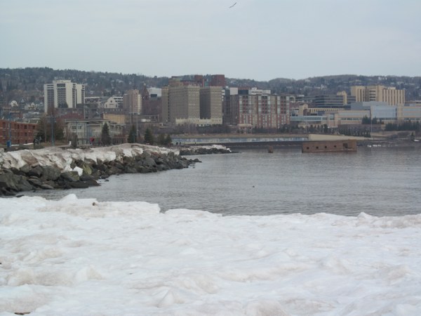


We did,
however, find time to tour the Lake
Superior Maritime Visitor Center.


We made our
way through the touristy Canal
Park area and stopped at
the Subway for a lunch break.


We stopped for a bathroom break in Grand Rapids, where I picked up another shot of a misspelled sign while waiting to relieve myself.

Moving on,
we passed through the town of Ball
Club.

We then
passed through the Chippewa
National Forest.


This lake
would be illegal in Canada
since it is called “Six
Mile Lake”
rather than “Ten Kilometer Lake.”
After a
long drive, we eventually made it to Sucker
Town. Travelling down Washington Street
made me feel like I was in a time warp. So little had changed over the many
decades since I had last seen it.

We stopped
briefly at the South Winnipeg Mall before a final stop at the Super One Foods
across the street.

At Les Douanes du Quebec, we were greeted with a “Bonjour” from a guard who appeared to be over
the age of 30. It was the first time in recent memory that I had been served by
a guard who had obviously reached the age of majority. He sent us on our way
quickly and we soon returned home.
No comments:
Post a Comment